CASE STUDY
AutoCAD plugin for a land surveying company
The straightforward tool we built was exactly what the business needed to streamline obtaining oil drilling permissions.
Tech stack/tools we used: C#, Microsoft Visual Studio, AutoCAD API, Carlson API
Client
Land surveying company seeking drawing precision and efficiency
A land surveying company specializing in generating surveys for oil drilling permissions needed a more efficient and precise method to create AutoCAD drawings. The client required two detailed surveys for each drilling location: an initial survey of the land to acquire permission and a second 3-D drawing of the completed drilling.
Problem
Manual survey creation undermined efficiency
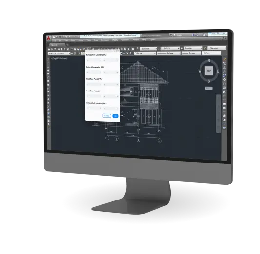
The manual process of creating surveys was labor-intensive, time-consuming, and prone to errors. Each survey had to include a variety of elements, such as Surface Hole Location (SHL), Point of Penetration (PP), First Take Point (FTP), Last Take Point (LTP), and Bottom Hole Location (BHL). Additionally, the surveys required detailed information like X and Y coordinates, distances, bearings, and azimuths. This complexity necessitated a more automated and precise solution.
Solution
Automated AutoCAD plugin for survey generation
Syberry developed a custom AutoCAD plugin to automate the creation of detailed surveys, integrating with AutoCAD and Carlson API. The plugin identifies and labels key elements, performs complex calculations, and presents results through a user-friendly interface.
The plugin consists of four layers: presentation, domain, infrastructure, and data. The presentation layer interacts with AutoCAD to receive commands and display results. The domain layer handles all domain logic, including mathematical calculations and specific operations related to survey points. The infrastructure layer manages communication between AutoCAD and Carlson API. Data layer provides the data model for the system through a shared data interface.
Challenge #1
Complex data migration
Integrating the plugin with the existing AutoCAD and Carlson API required careful planning and execution to ensure data integrity and system compatibility. The team meticulously mapped out the data migration process, validating each step to prevent data loss or corruption.
Challenge #2
High computational demand
The plugin needed to perform complex calculations in real-time without compromising performance. Syberry optimized the plugin's algorithms and utilized efficient data structures to meet these demands, ensuring smooth and fast operations even with large datasets.
Succeed faster with Syberry
If you submit a request today, your MVP will be ready
as early as December 26, 2025
Key features
Automated element identification
The plugin automatically identifies and labels key survey elements such as SHL, PP, FTP, LTP, and BHL, reducing manual input and errors.
Advanced calculation engine
An embedded calculation engine determines relationships between key points, calculating distances, bearings, and azimuths with high precision.
User-friendly presentation layer
The presentation layer allows users to input commands and view results easily, reducing the learning curve for surveyors.
YOU MIGHT ALSO BE INTERESTED IN...

Utility, Startups
Software that improves access to clean water
Explore how a custom software application lets developing countries' populations access safe drinking water. A startup with the ambitious goal of creating decentralized water systems in developing countries approached Syberry to engineer a web and desktop application that helps to provide uncontaminated water supplies in third-world countries. Despite the low-power limitations, we maximized the app’s functionality and developed features using just two gigabytes of computer memory.

Utility
Updating legacy water management software
This well-established enterprise decided to get bold — and refactor their outdated custom software.

Construction
Steel estimation solution
A leading developer of estimation solutions for steel construction companies, our client has been in the industry for over 40 years. Their first solution controlled about 8 percent of the market share. The client's idea was to improve the product and enhance the efficiency and accuracy of estimations and bids for steel erection companies by leveraging the client's deep industry knowledge.

Construction, ERP
ERP system for a plumbing business
Discover how a custom ERP solution made this company stand out from competitors.
Succeed faster with Syberry
If you submit a request today, your MVP will be ready
as early as December 26, 2025